Landslide
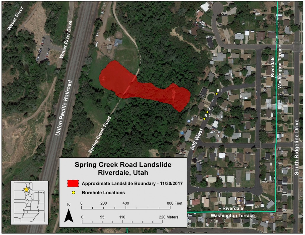
SPRING CREEK ROAD LANDSLIDE,
RIVERDALE, WEBER COUNTY, UTAH
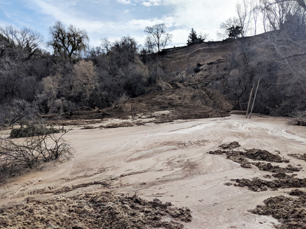
WHAT HAPPENED: The Spring Creek Landslide took place on November 19, 2017. The approximately 200-foot bluff gave way as water-laden debris, silty sand, and soil fell over 270 feet to the west of the hill.
TRIGGERS: There are several natural springs that are located halfway up on the hill. They continually erode material and deposit it on the pasture below.
CLASSIFICATION: Earthslide, Landslide
HOW TO FIX IT: Replant vegetation to give the slope some stability. Irrigation of springs and runoff would also help.


Comments
Post a Comment